Français (France)
  Nederlands (nl-NL)
 00:00 • intro | 00:29 • On Lake Vembanad | 03:41 • Life on the Meenachil River
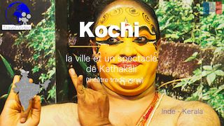
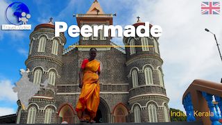
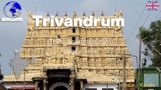
Personal creation from visual material collected during my trip India • South India • Tamil Nadu and Kerala (2018)
Map of places or practices in Kottayam on this site
• Use the markers to explore the content •
Waterways and Daily Life in the Kerala Backwaters
Landscapes Shaped by Water
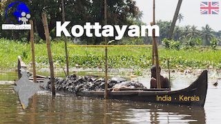
In central Kerala, the region around Kottayam forms part of the vast network of backwaters that extends along India’s Malabar Coast. These interconnected lakes, canals and rivers have shaped local life for centuries and remain one of the defining landscapes of southern India. The video explores this environment through two complementary settings: the broad waters of Vembanad Lake and the quieter course of the Meenachil River. Together, they reveal a territory where transportation, settlement patterns and daily activities continue to depend closely on the presence of water.
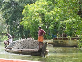
The scenes presented in the video show a landscape where waterways still function as living spaces rather than purely scenic environments. Boats move between villages, houses stand directly along the riverbanks, and vegetation forms a nearly continuous green corridor along the water. Coconut palms, cultivated areas and narrow canals illustrate the close relationship between agriculture, habitation and the aquatic environment that characterises much of Kerala.
Vembanad Lake and the Meenachil River
Vembanad Lake is the largest lake in Kerala and one of the most important inland water systems in southern India. Stretching across several districts, it historically served as a major transportation route linking inland settlements to coastal trading centres. Around Kottayam, the lake creates an open landscape of water channels, wetlands and cultivated lowlands that reflects the long adaptation of local communities to this humid environment.
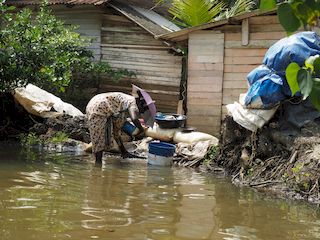
The Meenachil River presents a more intimate perspective on the backwaters. Flowing through inhabited areas and smaller waterways, it reveals aspects of everyday life that are less visible on the larger lake. Riverbanks lined with homes, local boats and small landing points demonstrate how these waterways remain integrated into ordinary social and economic activities. The contrast between the wide spaces of the lake and the narrower river channels gives the video a varied and progressive reading of the region.
Historical and Cultural Context of the Backwaters
The backwaters played a major role in the historical development of Kerala. Before the expansion of modern roads and railways, these waterways formed one of the principal transport systems of the region. Rice, spices, coconuts, timber and other goods were transported through canals and lakes connecting inland agricultural zones to the ports of the Arabian Sea.
Regional kingdoms, followed by Portuguese, Dutch and British colonial powers, all relied on this network for trade and communication. The landscapes visible today therefore reflect both natural geography and centuries of human adaptation. Many settlements, agricultural systems and local economic activities developed specifically because of the possibilities offered by the waterways.
What the Videos on This Site Make Particularly Clear
The videos on travel-video.info make the structure of these aquatic landscapes especially easy to understand. Because many sequences are created from carefully selected and animated photographs, viewers can observe details that are often difficult to perceive in continuous moving footage. The transitions between wide views and closer perspectives highlight the organisation of the riverbanks, the density of the vegetation and the relationship between villages and waterways.
This visual approach also helps reveal the gradual transition between the open waters of Vembanad Lake and the more enclosed environment of the Meenachil River, where human activity becomes more immediate and visible.
A Different Perspective on Kerala
Through the landscapes of Kottayam, the video presents Kerala not only as a region of tropical scenery, but also as a territory historically organised around water circulation and river life. The detailed pages dedicated to the Kerala backwaters provide additional context for understanding the environmental and cultural importance of these remarkable waterways.
Links to related pages
Videos
• Kerala •
Audio Commentary Transcript
The brackish lakes of South India have become one of the hotspots in South India. Here are some images of Vembanad Lake and the banks of the Meenachi River.
Near the town of Kottayam, whose name means: "inside a fort" lies the Vembanad Lake and a network of waterways named Backwaters. It is in fact complex sets of lagoons, lakes fed by rivers or rivers, a mixture of fresh water and sea water which sometimes mix. These natural waterways have been modified by man who has developed ditues and waterways for the transport of goods.

Music:
- - YouTube video library - Butterflies in Love
- - YouTube video library - Central Park
- - YouTube video library - Court and Page
- - YouTube video library - Evil March, (© Evil March by Kevin MacLeod is licensed under a Creative Commons Attribution 4.0 license. https://creativecommons.org/licenses/by/4.0/
- Source: http://incompetech.com/music/royalty-free/index.html?isrc=USUAN1100727
- Artist: http://incompetech.com/)
- - YouTube video library - Flowers in the Rain
Disclaimer: Despite its appropriateness, copyright issues prevent the use of indian traditional music in "Kottayam • Kerala Backwaters • Kerala, India ", hence the use of royalty-free music. Despite our careful selection, some might regret this decision, which is necessary to avoid potential lawsuits. Although difficult, this decision is the only viable solution.