Français (France)
  Nederlands (nl-NL)
 00:00 • intro | 00:08 • Historical and cultural context | 00:33 • Role of Travel-video.info | 00:54 • Google Maps | 02:00 • Languages | 02:16 • Video pages | 02:39 • Monuments pages | 03:25 • Dynasties pages | 04:04 • Some statistics | 04:11 • Navigarton
Personal creation from visual materials collected during my travels:
Behind every monument, a story
Presentation of Travel-video.info
The video at the top of this page illustrates the general spirit of the site. Using India as an example, it shows the scope and depth of the content: it is not only about viewing images, but about placing each monument, each site, and each tradition within their historical and cultural context.
The central pages of the site are all structured around a video. Each one presents elements of heritage — whether architectural, natural, or traditional — through images taken on location. Every video is complemented by texts, maps, and links that allow for deeper exploration.
Each element shown in a video — whether a monument, a natural site, or a living tradition — also has its own “heritage” page. These pages cover two essential aspects:
- the history or context, and the role played in its time or within the community,
- the architecture, form, or practice, whether it involves style, materials, gestures, or cultural influences.
In this way, the videos provide the visual entry point, while the heritage pages offer the key to understanding. It is this articulation between image and text that gives the site its distinctive character.
Historical and Cultural Context
The site is based on journeys undertaken in different countries, with a particular focus on India, which is currently the most extensively documented area. Each video is created from photos taken on location and then placed back into their historical, cultural, and religious context. The aim is not only to show images, but to explain how monuments, natural sites, and traditions are embedded in the history of the dynasties, religions, and regions that give them meaning.
The Role of Travel-video.info
Travel-video.info is more than a visual travel diary. Its purpose is to connect images with history, showing that behind every monument or cultural practice there is a memory to be explored. The site is intended for a broad audience: curious travellers, teachers, researchers, students, and heritage enthusiasts. It offers reliable, neutral, and structured content that can be explored at different levels of depth.
Languages
The entire site is available in three languages: French, English, and Dutch.
Language selection is done using the menu at the top of each page.
The translations are not automatic: every text is written and adapted in each of the three languages, ensuring a clear and consistent presentation. This approach guarantees the same level of historical and cultural accuracy, regardless of the chosen language.
The content remains identical across all languages: the same videos, maps, and “heritage” pages are available. Visitors can therefore navigate freely in the language most familiar to them, while still accessing the full range of information.
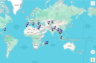
Google Maps
Maps play a central role in the organisation of the site. They allow visitors to move from a global view to a more detailed discovery:
- from the World to the Countries visited,
- for India, from the States to the Videos,
- from the Countries (and, for India, also from the States) to the Videos,
- from the Videos to the Monuments presented.
This progression reflects the spirit of the site: starting with an overview, then guiding step by step towards more detail.
The maps also integrate Street View, which makes it possible to explore the immediate surroundings of the monuments. The tool is especially relevant on the Video pages, where the geolocation refers directly to the sites filmed.
On the higher levels (World, Countries or States), the location shown is calculated as the average of the coordinates of the monuments concerned. The starting point in Street View may therefore seem unfamiliar or imprecise, but it reflects the grouping of several sites.
It is important to note that the Monument pages do not include a Google Map. This choice is deliberate:
- it makes it possible to group Monuments into larger sets (by Country, by State, or by Video),
- it avoids the multiplication of maps, which would generate additional costs,
- it ensures clearer and more coherent navigation throughout the site.
In this way, maps — enriched by Street View — are used as tools for orientation and context, without overloading the individual pages.
Video Pages
Each video page brings together several complementary elements:
- The video itself, accompanied by a Google Map showing the location of the monuments and traditions presented.
- An explanatory text, providing the historical, cultural, and religious context of the site.
In addition to this main content, each video page includes three important modules:
- List of links in the right-hand column:
- dynasties connected with the region,
- list of monuments appearing in the video,
- list of other films related to the place.
- Globe (and, for India, maps of the country and the State):
- clicking on the globe leads to the country page,
- clicking on the map leads to the State page (in the case of India).
- Thumbnail gallery: provides quick access to other videos from the same country, or from the same State in India.
Each video page thus serves as a central entry point, linking images, maps, and explanations to the wider structure of the site.
Heritage Pages
Each element shown in a video — whether a monument, a natural site, or a living tradition — has its own dedicated page, called a “heritage page.”
These pages always follow the same structure:
- An image block: photographs of the site or practice, and a banner linking to the corresponding video.
Two main sections:
- History or context, explaining the role played by the site or tradition in its time or within the community.
- Architecture, form, or practice, detailing material or immaterial aspects such as style, materials, gestures, symbols, or cultural influences.
Heritage pages do not include Google Maps. This choice is deliberate, in order to group sites at higher levels (Countries, States for India, or Videos), avoid the multiplication of maps, and ensure clearer navigation.
These pages therefore allow visitors to move from a visual approach (videos, images) to a more detailed analysis, while keeping a consistent structure — whether the subject is an architectural monument, a natural landscape, or a cultural tradition.
Dynasties
For India, the site offers a detailed presentation of the main dynasties that ruled the subcontinent. Each dynasty is placed within its territory, its chronology, and its historical role.
These pages help to understand the political and cultural framework in which the monuments were built. They complement the video and heritage pages by providing a broader view of regional history.
Navigation on the Site
Navigation is based on a simple menu, organised around four main sections: Countries, Videos, Heritage, Journeys.
- A click on a menu item opens a presentation page that explains the logic of the section and provides links to its subcategories.
- A click on a sub-menu directly displays the list of related pages.
- Search is available on all pages. On desktop, it is located in the top right-hand corner; on smartphones, it is accessible in the menu. It allows quick access to a monument, a video, or a specific theme.
This dual system — presentation pages and search function — offers both guided and free exploration, adapted to the needs of every visitor.
Glossary
The site also includes a glossary. Certain words appear underlined in the texts: a simple click opens a concise definition, available in all three languages. This system makes it possible to explain historical, religious, or architectural terms without interrupting the reading flow.