

 Français (France)
  Nederlands (nl-NL)
 Of the Malla dynasty ruled for approximately 567 years, ± between 1201 and 1768 over all or part of Nepal.
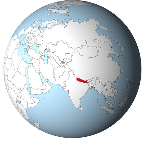
This map illustrates the maximum territory that the Malla Dynasty had reached at its height, covering the current regions of __ in Nepal. Its main purpose is to provide a visual aid to understand the geographical extent of this dynasty. However, it's important to note that the contemporary borders of these regions may not necessarily coincide with the historical territories.
The Malla Dynasty and the Urban Flowering of Medieval Nepal
A ruling house central to the history of the Kathmandu Valley
The Malla dynasty holds a central place in the history of Nepal, especially in the political and cultural development of the Kathmandu Valley. Its rulers became prominent from the thirteenth century and remained influential until the conquest of the valley by Prithvi Narayan Shah of Gorkha in the eighteenth century. During this long period, the Mallas shaped the institutions, cities, religious traditions, artistic production and economic networks of Nepal Mandala, the historical cultural region centred on the valley.
Their history can be divided into two broad phases. The first was the period of a more unified Malla kingdom, when the valley was governed under a single royal framework. The second followed the death of Yaksha Malla in the fifteenth century, when the valley was divided among rival kingdoms, principally Kantipur, Lalitpur and Bhaktapur. This division did not immediately weaken the cultural vitality of the region. On the contrary, rivalry among the courts stimulated artistic patronage, temple construction, urban embellishment and ceremonial display.
Royal authority organised through cities and communities
The Malla state was not a large territorial empire. Its strength lay in the dense urban and agricultural environment of the Kathmandu Valley. The kings ruled over compact but prosperous city states, supported by rice fields, irrigation systems, artisan communities, merchant groups and religious institutions. Political power was therefore closely tied to urban organisation and social hierarchy.
Jayasthiti Malla is traditionally associated with important social and administrative reforms. His reign is remembered for the regulation of occupations, social groups and legal customs, although later tradition may have amplified his role. Even so, he represents a key moment in the effort to structure society under royal authority. The Malla kings sought to organise not only political rule, but also the relationships between caste groups, professional communities, temples, monasteries and landholding networks.
After the division of the valley, the three principal capitals developed their own courts and political identities. Kantipur, Lalitpur and Bhaktapur each maintained royal palaces, ritual centres, markets and networks of dependent villages. This urban fragmentation created competition, but it also preserved a shared cultural world based on Newar society, Sanskritic kingship and local religious traditions.
Architectural patronage and the shaping of Nepalese urban identity
The most visible legacy of the Mallas is architectural. Many of the palace squares, temples, courtyards, water fountains and public monuments that define the historic centres of Kathmandu, Patan and Bhaktapur were built, enlarged or embellished during the Malla period. The royal squares became ceremonial stages where political authority, religious devotion and civic identity were displayed together.
The Malla kings were major patrons of art and architecture. Pratap Malla in Kantipur, Siddhi Narasimha Malla in Lalitpur and Bhupatindra Malla in Bhaktapur are among the rulers most strongly associated with cultural patronage. Their courts supported woodcarvers, metalworkers, painters, stone sculptors, architects, poets, ritual specialists and musicians.
Malla architecture was not merely decorative. Temples, palace gates, columns, statues and rest houses affirmed royal legitimacy and connected kingship with divine protection. The built environment of the valley became a political language. Each capital used monuments to proclaim prestige, piety and independence while remaining part of a shared artistic tradition.
Religious plurality within a Newar cultural framework
The Malla period was marked by a close interaction between Hinduism and Buddhism, especially within Newar society. The kings were generally associated with Hindu kingship and with the cult of protective deities such as Taleju. At the same time, Buddhist monasteries, Vajrayana traditions, bodhisattva cults and local ritual practices remained deeply embedded in the life of the valley.
This religious plurality was not a marginal feature of Malla rule. It shaped festivals, processions, royal rituals, artistic themes and urban space. Hindu and Buddhist traditions often existed side by side, sometimes sharing ritual specialists, sacred places and symbolic forms. The Malla kings used religious patronage to reinforce social order, legitimise their rule and maintain the relationship between court, city and community.
The festivals of the valley also acquired strong political significance. Public ceremonies brought together rulers, priests, merchants, artisans and neighbourhood associations. Through these rituals, the kingdom was made visible as a sacred and civic order.
Economic strength from agriculture, crafts and trans Himalayan trade
The Malla economy rested first on the fertile agricultural landscape of the Kathmandu Valley. Intensive farming, especially rice cultivation, supported dense urban populations and provided the material foundation of royal power. Irrigation, ponds, channels and water spouts were therefore both practical infrastructure and elements of ritual life.
Craft production formed another essential pillar of the economy. Newar artisans became renowned for woodworking, bronze casting, stone carving, painting and architectural decoration. Royal patronage, religious institutions and urban demand sustained these specialised crafts. The artistic achievements of the Malla period were therefore inseparable from the economic organisation of artisan communities.
Trade also gave the valley importance beyond its size. Nepal Mandala lay on routes connecting northern India with Tibet. Merchants transported salt, wool, metals, textiles, grain and ritual objects through these networks. The Malla kingdoms benefited from their position as intermediaries between the Himalayan world and the plains of South Asia.
A lasting legacy after the rise of Gorkha
The political independence of the Malla kingdoms ended in the eighteenth century when Prithvi Narayan Shah conquered the Kathmandu Valley and incorporated its cities into the expanding Gorkha state. Kantipur, Lalitpur and Bhaktapur lost their sovereignty, and the centre of power shifted to the Shah dynasty.
Yet the Malla legacy remained fundamental to Nepal’s historical identity. Their period gave the valley much of its classical urban form, its temple architecture, its ritual calendar, its artistic vocabulary and its civic traditions. The Mallas were not simply medieval kings of a small mountain valley. They were the rulers under whom Nepal Mandala became one of the most distinctive urban and cultural landscapes of the Himalayan world.
The Geographic Reach of the Malla Dynasty in Nepal
A compact kingdom centred on Nepal Mandala
The Malla dynasty ruled primarily over the Kathmandu Valley, the historical heart of Nepal Mandala. Their territory was not vast in comparison with the large kingdoms and empires of India or Tibet, but it was exceptionally important because of its density of population, agricultural productivity, urban development and position on trade routes between northern India and the Himalayan world. The geographic strength of the Mallas lay less in territorial size than in their ability to control a compact and prosperous valley.
During the earlier phase of Malla rule, the Kathmandu Valley was governed as a relatively unified kingdom. This territory included the main urban centres that later became known as Kantipur, Lalitpur and Bhaktapur, together with their surrounding villages, farmlands, shrines, water systems and market networks. The valley’s natural setting, enclosed by hills but connected to wider trade corridors, gave the Mallas both protection and opportunity.
The Kathmandu Valley as the political core of Malla authority
The central territory of the Malla dynasty was the fertile basin of the Kathmandu Valley. Its agricultural resources supported a dense urban population and allowed the growth of royal courts, religious institutions and specialised artisan communities. Rice fields, irrigation channels, ponds, roads and settlements formed the practical foundation of Malla authority.
Control over the valley meant control over the main centres of Newar civilisation. The Malla kings governed through cities, neighbourhoods, temples, monasteries, guild-like artisan communities and landholding networks. Their power was therefore territorial, social and ritual at the same time. The land around the cities supplied food and revenue, while the cities provided administrative organisation, craft production, religious prestige and commercial vitality.
The valley was also a sacred geography. Royal authority was connected with temples, protective deities, pilgrimage routes and public festivals. The Mallas did not simply occupy land; they shaped an integrated political and ritual landscape in which kingship, urban society and religious life reinforced one another.
Limited influence over the surrounding hill regions
Although the Mallas were strongest inside the Kathmandu Valley, their influence could extend into the surrounding hills and along routes leading toward neighbouring regions. These outer zones, however, were more difficult to control permanently. The geography of central Nepal was fragmented, with ridges, valleys, river corridors and local chiefdoms that often maintained considerable autonomy.
Malla authority in these areas was therefore variable. It could take the form of military expeditions, tribute relations, control of strategic passes, marriage alliances or influence through trade. The valley’s rulers were powerful enough to matter beyond their immediate basin, but they did not create a strongly integrated mountain empire.
This distinction is important. The Mallas ruled a compact urban kingdom rather than a broad territorial state. Their influence radiated outward from the valley, but their most reliable power remained concentrated in the fertile and urbanised centre of Nepal Mandala.
The division into Kantipur, Lalitpur and Bhaktapur
After the death of Yaksha Malla in the fifteenth century, the political geography of the dynasty changed profoundly. The unified kingdom fragmented into rival Malla states, especially Kantipur, Lalitpur and Bhaktapur. These three capitals shared a common cultural world, but each controlled its own city, surrounding villages, ritual centres and revenue base.
Kantipur, corresponding to Kathmandu, became a major political and commercial centre in the western and central part of the valley. Lalitpur, or Patan, developed as a strong urban and artistic centre, closely associated with metalwork, Buddhist institutions and refined court culture. Bhaktapur, or Bhadgaon, controlled the eastern part of the valley and possessed a powerful agricultural hinterland.
This division did not eliminate the common identity of the valley, but it transformed internal relations. The three Malla courts competed for prestige, territory, revenue, craftsmen and religious legitimacy. Their frontiers were close and sometimes politically unstable. Rivalry among the capitals encouraged architectural and artistic patronage, but it also weakened their ability to respond collectively to external threats.
Relations with neighbouring hill kingdoms and Gorkha
The limited geographic extension of the Mallas shaped their relations with neighbouring dynasties and principalities. Around the valley lay a mosaic of hill states, local rulers and emerging powers. These neighbours were often attracted by the wealth of the valley, whose cities controlled trade, crafts and agricultural surplus.
The most important external challenge eventually came from Gorkha. Under Prithvi Narayan Shah, Gorkha pursued a strategy of surrounding, isolating and conquering the valley. The political fragmentation of the Malla kingdoms made this task easier. Kantipur, Lalitpur and Bhaktapur were culturally brilliant but politically divided. Their rivalries prevented a unified response to Gorkha expansion.
The fall of the Malla kingdoms in the eighteenth century shows how their compact geography was both a strength and a weakness. The valley was rich and defensible, but once its trade routes and surrounding positions were threatened, its internal divisions became dangerous.
Connections with northern India and Tibet
The Malla territories gained importance from their position between northern India and Tibet. Routes southward linked the valley to the plains of India, including regions influenced at different times by Rajput, Sultanate and later Mughal political worlds. These contacts brought religious, artistic, monetary and diplomatic influences into Nepal Mandala.
To the north, routes across the Himalayas connected the valley with Tibet. Newar merchants played an important role in trans Himalayan exchange, carrying salt, wool, metals, textiles, grain and ritual objects. The Malla kingdoms benefited from this intermediary position. Their geographic location made the valley a commercial bridge between two larger cultural and economic zones.
A small territory with exceptional regional influence
The geographic extension of the Malla dynasty remained concentrated in the Kathmandu Valley, with fluctuating influence over surrounding hills and trade routes. The Mallas did not rule a vast empire, but they controlled one of the most important urban and cultural landscapes of the Himalayan region.
Their territorial position shaped all their relationships. It made them prosperous through agriculture and trade, culturally rich through urban patronage, and diplomatically important between India and Tibet. It also made them vulnerable to rival hill powers, especially Gorkha. The Malla achievement therefore lies in the transformation of a limited valley territory into a political, economic and artistic centre whose influence far exceeded its geographic size.
The Malla rulers generally bore the title of king or raja within the framework of Nepal Mandala. After the death of Yaksha Malla, the Kathmandu Valley was divided among several kingdoms, mainly Kantipur, Lalitpur and Bhaktapur; later reigns were therefore simultaneous in different branches.
Unified Kathmandu Valley
- Arideva Malla (c. 1201–1216) • First generally recognized Malla king of the Kathmandu Valley. His dynastic origin remains debated.
- Abhaya Malla (c. 1216–1255) • His reign was marked by internal and external conflicts. He probably died during the great earthquake of 1255.
- Jayadeva Malla (c. 1255–1258) • He ruled briefly after Abhaya Malla. He was deposed and is often regarded as the last direct successor of the first line.
- Jayabhimadeva (c. 1258–1271) • A king associated with the house of Bhonta, he ruled during a period of transition. His reign was linked to a political arrangement with Jayasimha Malla.
- Jayasimha Malla (c. 1258–1274) • A king from the house of Tripura, he shared or contested authority during an unstable phase. He was eventually removed from power.
- Ananta Malla (c. 1274–1308) • He faced external pressure, especially from the Khasa kingdom. His death opened a period of vacancy or political uncertainty.
- Jayanandadeva (c. 1313–1320) • A king with limited power, he ruled while administration was dominated by influential nobles. His reign illustrates a temporary weakening of royal authority.
- Jayari Malla (c. 1320–1344) • He ruled during a period marked by the return of Devalakshmi Devi and by Khasa attacks. The kingdom remained fragile under external pressure.
- Jayarajadeva (c. 1348–1361) • A largely nominal king, he ruled under the influence of Devalakshmi Devi. His reign was also marked by tensions with the Bengal Sultanate.
- Jayarjunadeva (c. 1361–1382) • Last king before the effective rise of Jayasthiti Malla. He was removed when Jayasthiti became the chief authority of the kingdom.
- Jayasthiti Malla (c. 1382–1395) • He restored strong royal authority in the valley. His reign is associated with lasting social, legal and administrative reforms.
- Jayadharma Malla (c. 1395–1408) • He continued the dynasty after Jayasthiti Malla. His reign maintained the political unity of the valley.
- Jayajyotir Malla (c. 1408–1428) • He ruled before the long reign of Yaksha Malla. His reign belongs to the consolidation phase of unified Malla power.
- Yaksha Malla (c. 1428–1482) • He was one of the last great kings of the unified valley. After his death, Malla power was divided among rival kingdoms.
Kantipur, Kathmandu
- Ratna Malla (1482–1520, Kantipur) • First Malla king of Kantipur after the division of the valley. He established his branch as the dominant power in Kathmandu.
- Surya Malla (1520–1530, Kantipur) • He maintained Kantipur’s authority after Ratna Malla. His reign is less documented than those of his successors.
- Amara Narendra Malla (1530–1560, Kantipur) • He continued the consolidation of the kingdom of Kantipur. His reign belongs to the phase of growing rivalry among the Malla cities.
- Mahendra Malla (1560–1574, Kantipur) • He is associated with administrative and monetary development in Kantipur. His reign strengthened the urban prestige of the capital.
- Sadashiva Malla (1574–1583, Kantipur) • He ruled during a period of internal tensions. His authority was limited by court rivalries.
- Shivasimha Malla (1583–1619, Kantipur) • An energetic king of Kantipur, he extended his influence over Lalitpur. His reign changed the balance among the kingdoms of the valley.
- Lakshmi Narasimha Malla (1619–1641, Kantipur) • He ruled before the cultural age of Pratap Malla. His reign was marked by continued rivalry among the Malla kingdoms.
- Pratap Malla (1641–1674, Kantipur) • Great king of Kantipur, he was an important patron of art, literature and architecture. His reign marked a cultural high point of Kathmandu.
- Nripendra Malla (1674–1680, Kantipur) • He succeeded Pratap Malla in a complex dynastic context. His reign was relatively brief.
- Parthibendra Malla (1680–1687, Kantipur) • He continued the Kantipur line after Nripendra Malla. His reign remained dominated by the political rivalries of the valley.
- Bhupalendra Malla (1687–1700, Kantipur) • He ruled Kantipur at the end of the seventeenth century. His reign maintained dynastic continuity without restoring the unity of the valley.
- Bhaskara Malla (1700–1722, Kantipur) • His long reign gave Kantipur a measure of stability. It preceded a phase of stronger dynastic tensions.
- Jagajjaya Malla (1722–1736, Kantipur) • He ruled before the final crises of Kantipur. His authority operated in a context of increasing competition among neighbouring kingdoms.
- Jaya Prakash Malla (1736–1746 and 1750–1768, Kantipur) • Last Malla king of Kantipur, he was restored after an interruption of his reign. He lost his kingdom to Prithvi Narayan Shah of Gorkha.
- Jyoti Prakash Malla (1746–1750, Kantipur) • He ruled during the interruption of Jaya Prakash Malla’s power. His short reign belongs to the final dynastic struggles of Kantipur.
Lalitpur, Patan
- Purandara Simha (c. 1580–1600, Lalitpur) • First ruler usually placed in the autonomous chronology of Lalitpur. His exact dynastic status remains debated.
- Harihara Simha (c. 1600–1609, Lalitpur) • He ruled Lalitpur before direct intervention from Kantipur. His reign shows the political fragility of the city.
- Shivasimha Malla (1609–1619, Lalitpur, rule from Kantipur) • King of Kantipur, he also exercised authority over Lalitpur. This reign reflects external domination rather than an autonomous local branch.
- Siddhi Narasimha Malla (1620–1661, Lalitpur) • Great king of Lalitpur, he strengthened the political and cultural identity of the city. His reign is associated with the architectural development of Patan.
- Srinivasa Malla (1661–1685, Lalitpur) • He continued the artistic and religious patronage of Lalitpur. His reign contributed to the prestige of Patan in the valley.
- Yoga Narendra Malla (1685–1705, Lalitpur) • He is one of the best known rulers of Lalitpur. His reign is associated with strong cultural and ritual memory.
- Loka Prakash Malla (1705–1706, Lalitpur) • He ruled briefly after Yoga Narendra Malla. His death or removal opened a period of instability.
- Indra Malla (1706–1709, Lalitpur) • Also called Purandara Malla, he ruled Lalitpur during a difficult succession phase. His reign was short.
- Vira Narasimha Malla (1709, Lalitpur) • He was a very brief ruler of Lalitpur. His reign illustrates the rapid changes of power in the early eighteenth century.
- Vira Mahindra Malla (1709–1715, Lalitpur) • He restored a degree of continuity after very short reigns. His authority nevertheless remained fragile.
- Riddhi Narasimha Malla (1715–1717, Lalitpur) • He ruled briefly during a period of strong rivalry among the Malla courts. His reign preceded an intervention from Kantipur.
- Mahindrasimha Malla (1717–1722, Lalitpur, king of Kantipur) • King of Kantipur, he exercised power in Lalitpur through domination or political installation. His rule in Lalitpur was linked to rivalry among the cities.
- Yoga Prakash Malla (1722–1729, Lalitpur) • He restored a local line in Lalitpur. His reign was marked by continuing dynastic tensions.
- Vishnu Malla (1729–1745, Lalitpur) • He ruled Lalitpur during a relatively more stable period. His reign preceded the final decades of Malla crisis.
- Rajya Prakash Malla (1745–1758, Lalitpur) • He ruled while the power of Gorkha was beginning to weigh on the valley. His authority remained subject to internal rivalry.
- Vishvajit Malla (1758–1760, Lalitpur) • He ruled briefly before a series of external interventions. His fall illustrates the weakening of Lalitpur.
- Jaya Prakash Malla (1760–1761 and 1763–1764, Lalitpur, king of Kantipur) • King of Kantipur, he was also installed in Lalitpur for brief periods. These reigns reflect the political manipulation of Malla thrones.
- Ranajit Malla (1762–1763, Lalitpur, king of Bhaktapur) • King of Bhaktapur, he temporarily occupied the throne of Lalitpur. His intervention shows the extreme political fragmentation of the valley.
- Dal Mardan Shah (1764–1765, Lalitpur) • A prince connected with Gorkha, he was installed in Lalitpur during the final period of the Malla kingdoms. His reign foreshadows the Shah advance into the valley.
- Tej Narasimha Malla (1765–1768, Lalitpur) • Last Malla king of Lalitpur, he was overthrown during the conquest of the valley by Gorkha. His reign marks the end of Patan’s autonomy.
Bhaktapur, Bhadgaon
- Raya Malla (1482–1509, Bhaktapur) • First Malla king of Bhaktapur after the division of the kingdom. He founded the branch that long controlled Bhadgaon.
- Bhuwana Malla (1505–1519, Bhaktapur) • He probably ruled in overlap or close succession with Raya Malla. The exact chronology of this period remains uncertain.
- Prana Malla (1519–1547, Bhaktapur) • He consolidated the Bhaktapur branch in the sixteenth century. His reign belongs to the period of organization of the separate Malla kingdoms.
- Vishva Malla (1547–1560, Bhaktapur) • He maintained Bhaktapur’s authority in a divided valley. His reign preceded the complex period of Trailokya Malla.
- Trailokya Malla (1560–1613, Bhaktapur, with Tribhuvana Malla and Ganga Rani) • He ruled in a context of co-rule or shared authority. This period remains complex in the dynastic traditions of Bhaktapur.
- Jagajjyoti Malla (1613–1637, Bhaktapur) • He was an important king of Bhaktapur and a patron of court culture. His reign contributed to the artistic prestige of the city.
- Naresha Malla (1637–1644, Bhaktapur) • He ruled briefly after Jagajjyoti Malla. His reign maintained the continuity of the Bhaktapur branch.
- Jagat Prakasha Malla (1644–1673, Bhaktapur) • He was an active ruler of Bhaktapur. His reign is associated with the cultural and religious development of the city.
- Jitamitra Malla (1673–1696, Bhaktapur) • He strengthened the architectural prominence of Bhaktapur. His reign prepared the monumental age of Bhupatindra Malla.
- Bhupatindra Malla (1696–1722, Bhaktapur) • Great builder king of Bhaktapur, he is associated with several major monuments. His reign represents one of the artistic high points of the city.
- Ranajit Malla (1722–1769, Bhaktapur) • Last Malla king of Bhaktapur, he ruled until the city was conquered by Gorkha. His defeat ended the last major independent Malla branch.
 Links to the main sections of the site